Montréal: BouHenri-Bourassa
Tools: e1l3
Strategies: curb-frictionintersections
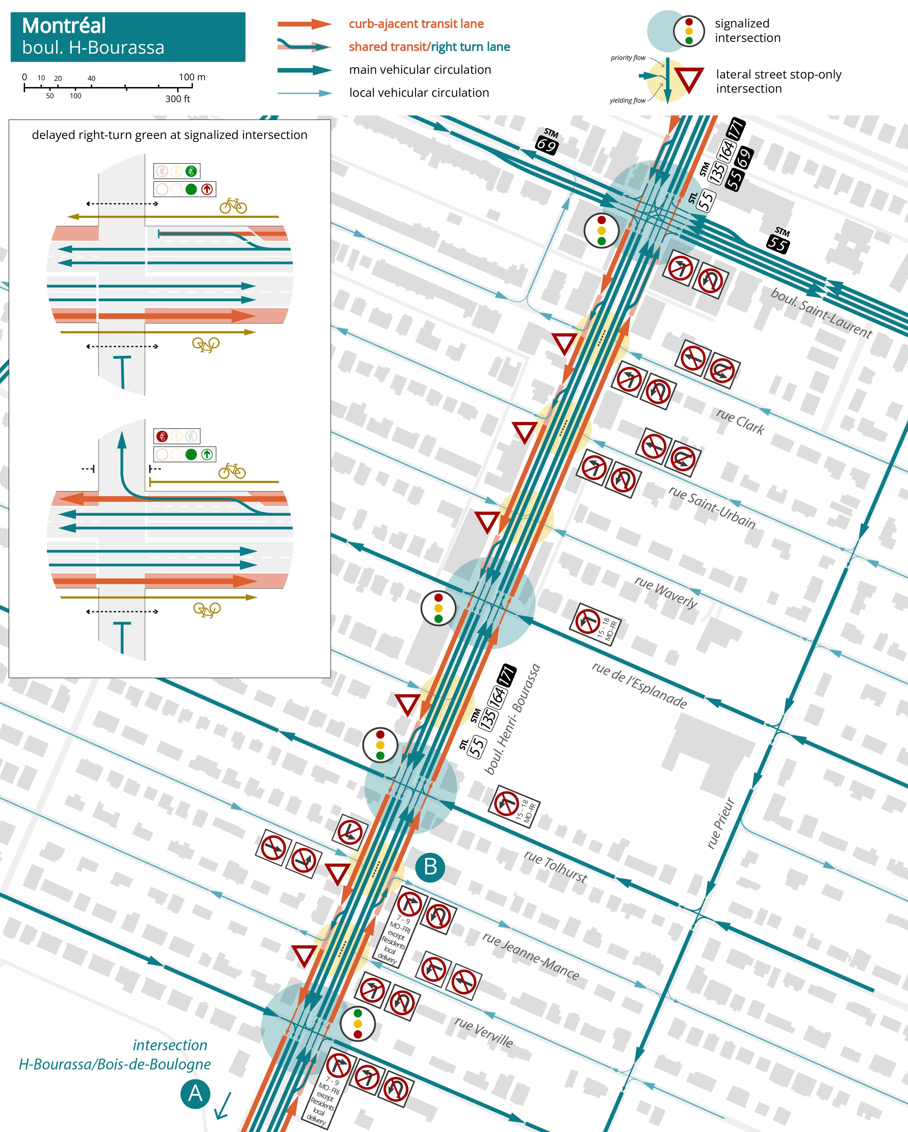
Boulevard Henri Bourassa is a major arterial thoroughfare and bus corridor spanning a long section of the northern side of the Island of Montréal. The city is redesigning this arterial as part of a program to implement “Sustainable Mobility Corridors” (Corridors de Mobilité Durable) across the Island. In the segment completed in 2025, the existing configuration of three general traffic lanes and a curb-adjacent reversible parking and peak-only transit lane (E2) has been redesigned to accommodate a lateral monodirectional protected bike lane, a curb-adjacent transit lane with an extended operational span (2 pm - 10 am) and two general traffic lanes. The curbside transit lane presents many discontinuities because it’s frequently interrupted to provide a right-turn lane into lateral streets, with east-west blocks spaced every 80 meters (260 feet).
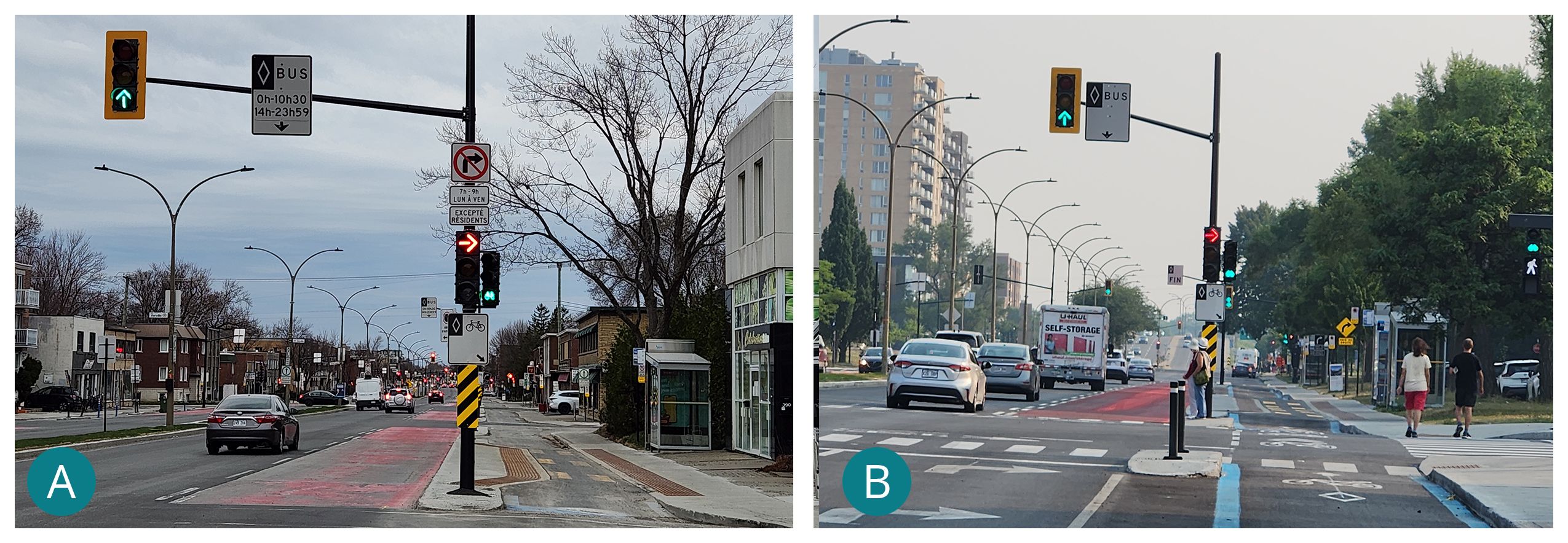
Potential delays for buses blocked by right-turn vehicles queuing to yield to bikes and pedestrians are particularly significant at signalized intersections, as a delayed right-turn green to protect through bike and pedestrian movements can last up to more than 20 seconds at certain intersections. To compensate, selective turn restrictions have been introduced during rush hours in the peak direction (e.g., 7 am - 9 am) at a few minor intersections, with exceptions for residents and local delivery, who are allowed to turn at all times. However, enforcement relies exclusively on drivers' compliance, as is the case for several other prohibited movements, such as left and through movements from and into lateral intersections (right-in/right-out, L3) at lateral-street-only stop-controlled intersections, which aren’t enforced with a full-height curb, but rather a fully surmountable one, because of accessibility concerns for emergency vehicles.