Stockholm: Södermalm

Tools: a1f1-f2l4

Strategies: divert-through-trafficpiroity-corriodors

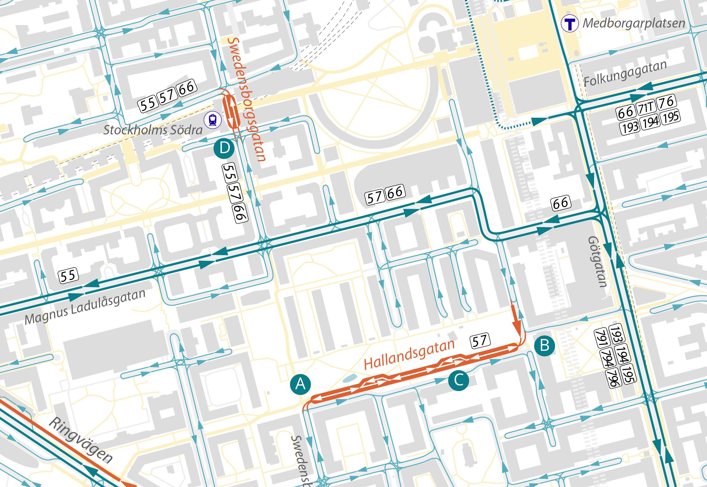
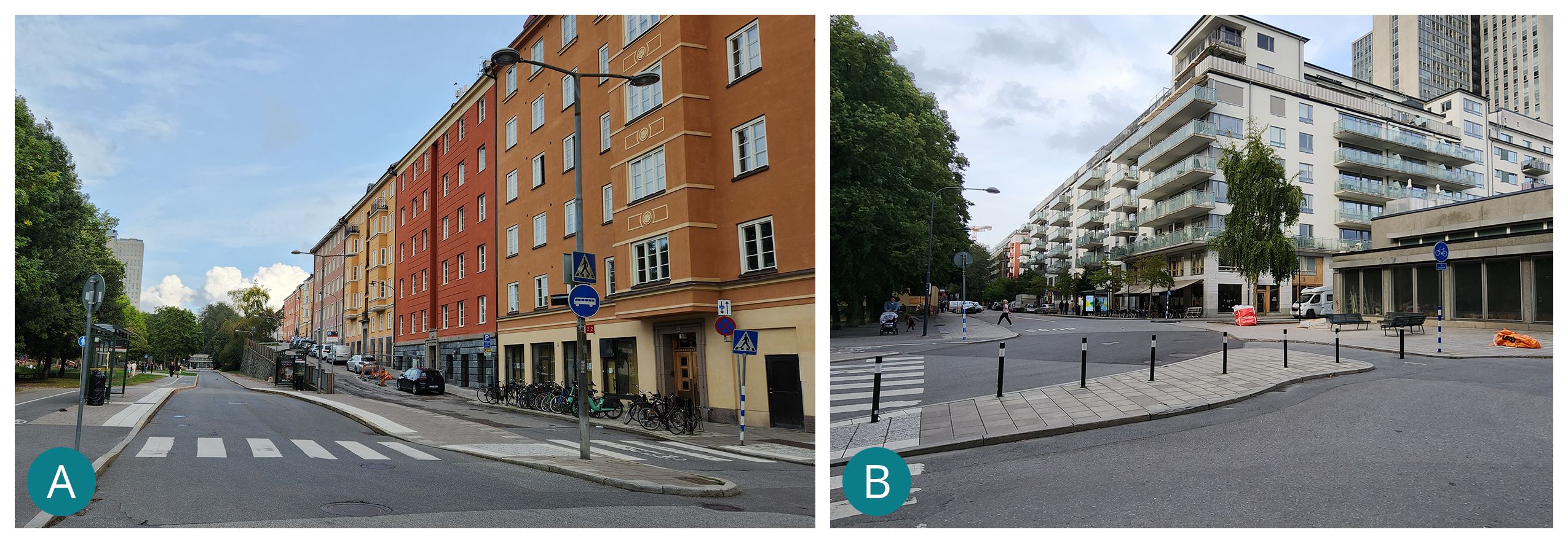
Stockholm’s Södermalm neighborhood is characterized by a circulation plan that limits through movements to a few corridors, while reserving most inner streets for local traffic. Using a mix of pedestrian-only streets, looping circulation patterns, and systematically dead-ending local streets with modal filters, notably along major thoroughfares such as Ringvagen and Götgatan, the western side of the neighbourhood is organized into three distinct local traffic pockets. Two short transit streets (A1), a block of Swedenborgsgatan in front of the Södra railway station access and Hollandsgatan, a one-lane transit street with passing loops bordering Rosenlundsparken, allow a few bus lines to serve the core of the neighbourhoods via local streets and cross between the pockets while preventing private vehicular through traffic.

circulation diagram
Through the extensive use of dead-ends, modal filters and one-ways, most inner streets on the western side of Södermalm experience very low traffic volumes. As a result, within the area defined by Götgatan, Ringvägen, and Hornsgatan—a dense urban district of approximately 1.2 square kilometers (0.45 square miles)—there are only three signalized intersections
A detail of circulation patterns in the areas around Hallandsgatan and Swedenborgsgatan.
A detail of circulation patterns in the area around Hallandsgatan and Swedenborgsgatan transit streets. The systematic dead-ending of streets, offset by a continuous pedestrian and cycling network, creates a circulation pattern reminiscent of suburban neighbourhoods, but within a relatively dense inner-city context. The letters indicate the locations of the images below.
pics of transit-only streets
The eastern (A–LEFT) and western (B–RIGHT) access points to Hallandsgatan, a bus-only street along the southern edge of Rosenlunds Park. It allows bus line 57 to serve the inner areas of the neighbourhood, connecting between separated traffic cells. On the right image, the modal filter separating the vehicular networks of the southern and central pockets is clearly visible.
images
LEFT (A). A pull-over bay along Hallandsgatan allows buses travelling in opposite directions to pass each other on sight. There are two such bays along this 300-metre single-lane, bidirectional transit street. RIGHT (B). This short segment of Swedenborgsgatan in front of Södra railway station is reserved for buses only.

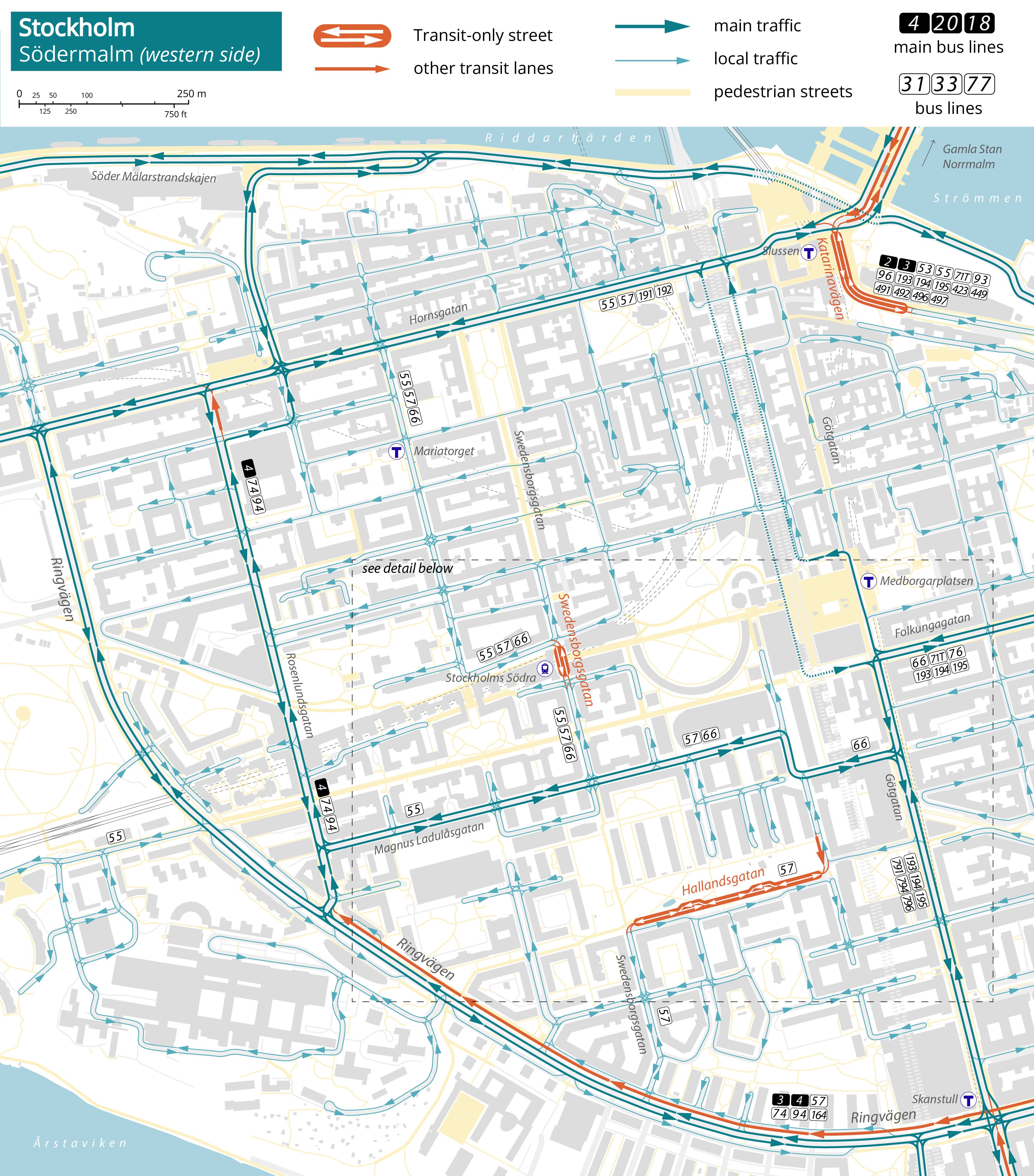
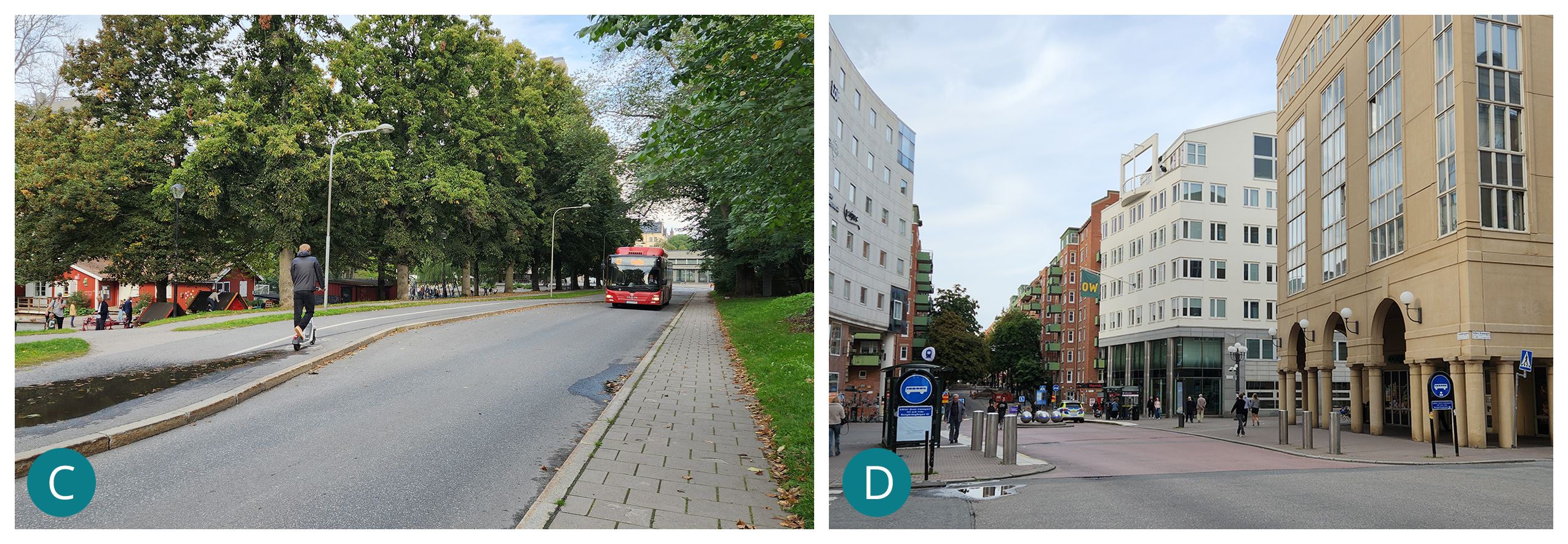
On the Eastern side, a short stretch of Katerinavägen near the T-bana station at Slussen has recently been transformed into a transit street as part of a broader reconstruction of the 1930s Slussen interchange node into a major transit hub. This way, traffic can’t use this thoroughfare as a north-south route through the eastern part of the neighbourhood, as was the case previously. This route carries some 25 buses per hour in each direction during the morning peak.

large-scale circulation diagram
In the eastern part of the neighbourhood, the subdivision into traffic pockets is less pronounced than in the western area. However, it is still characterised by extensive use of dead-ends and looping one-way streets to discourage through traffic on local streets and to establish priority corridors along major thoroughfares.

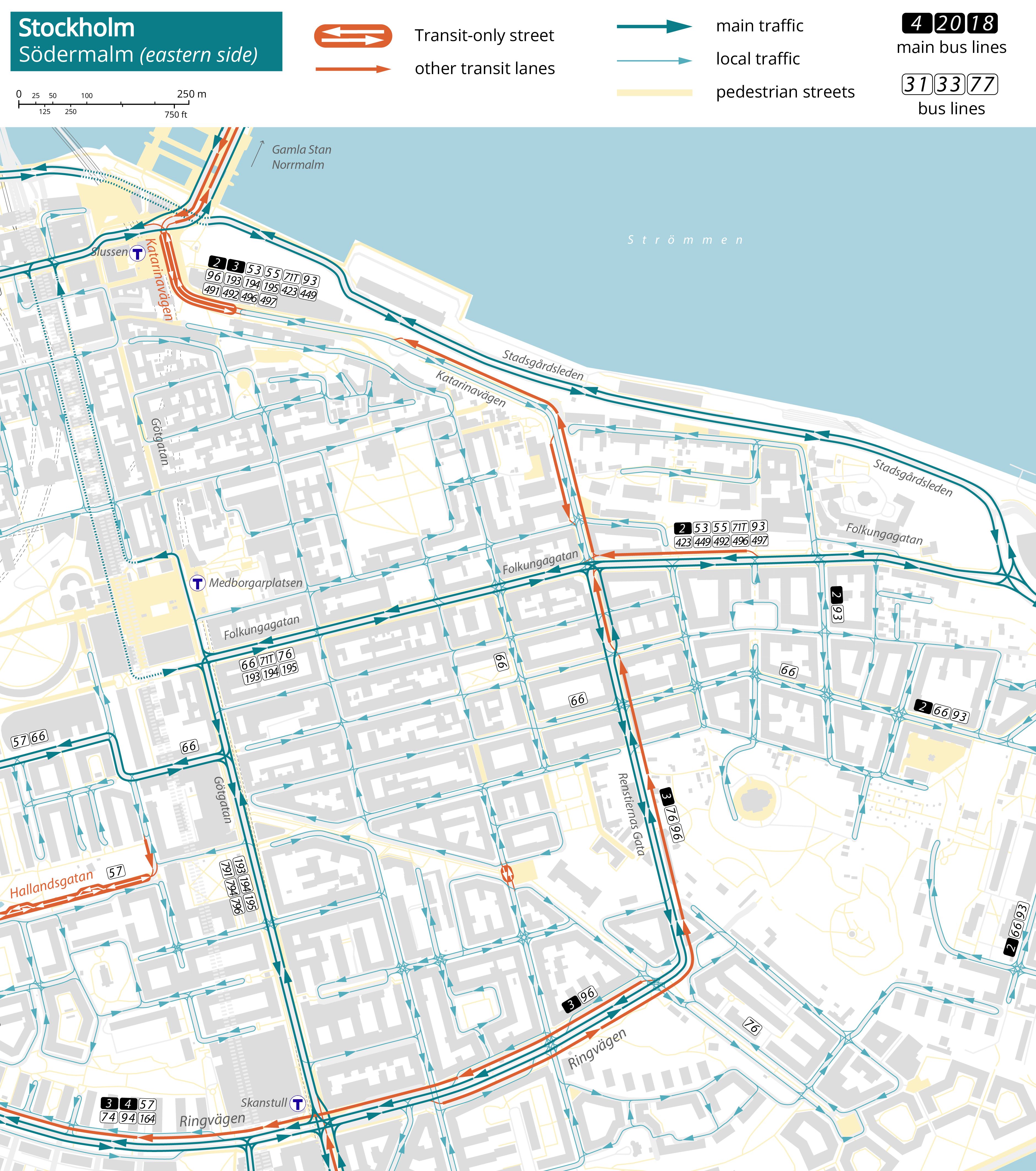
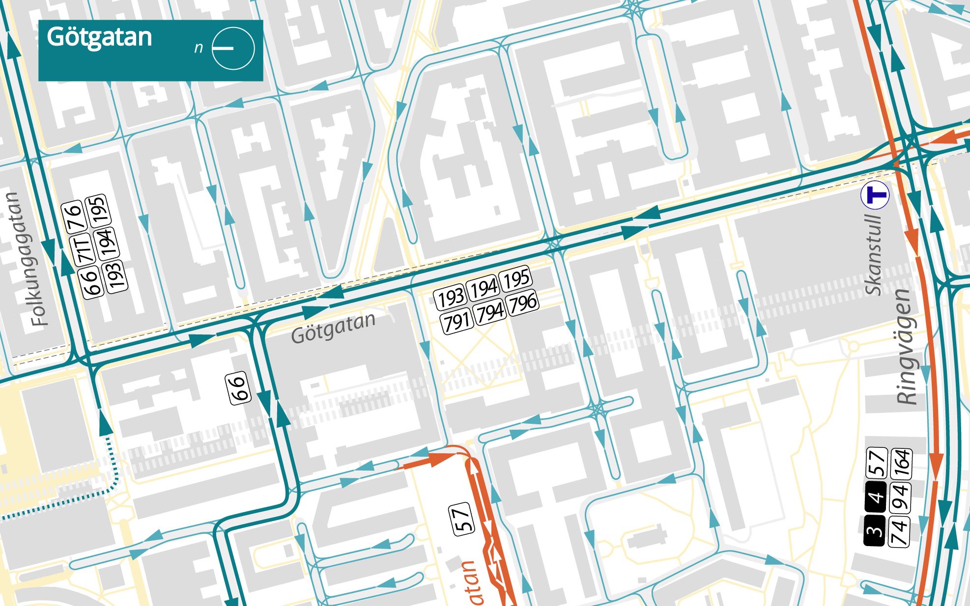
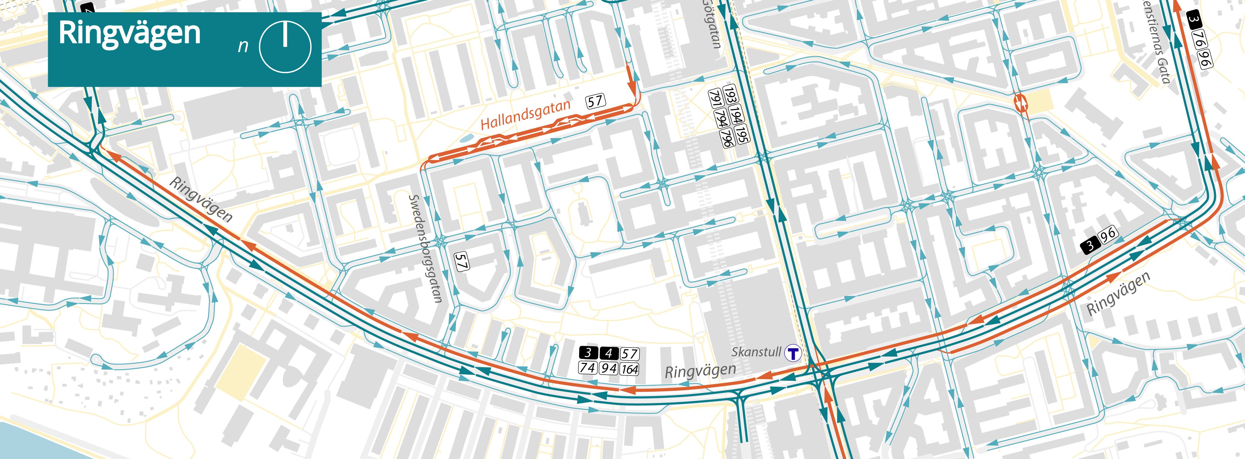
Finally, the use of dead-ends along Götgatan—a major transit corridor—together with a combination of dead-ends and service roads, coupled with curb-adjacent transit lanes, establishes a clear prioritization of transit flows along these corridors over movements on the intersecting local streets. Along Ringvägen, service roads and dead-ends deprioritize traffic from lateral streets.

circulation patters gotgatan
circulation pattern detail