Zürich: Bellevue
Tools: l1a1l3
Strategies: priority-corridorsintersectionsdivert-through-traffic
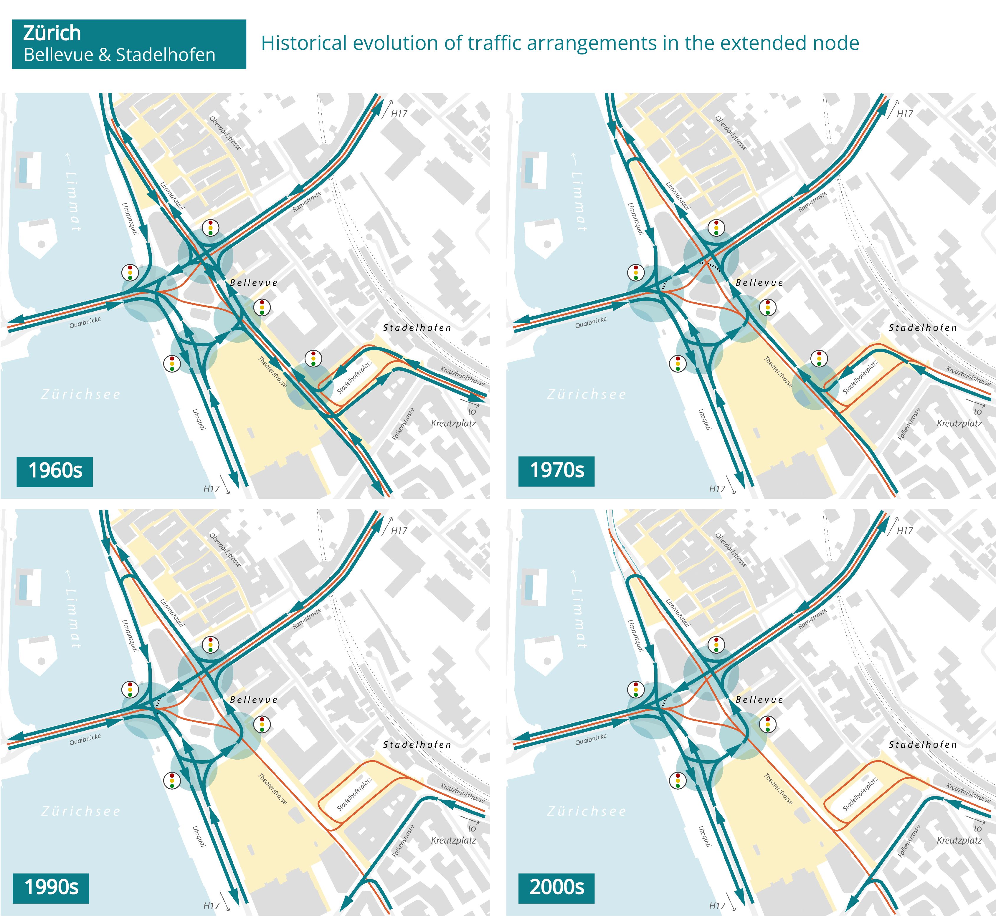
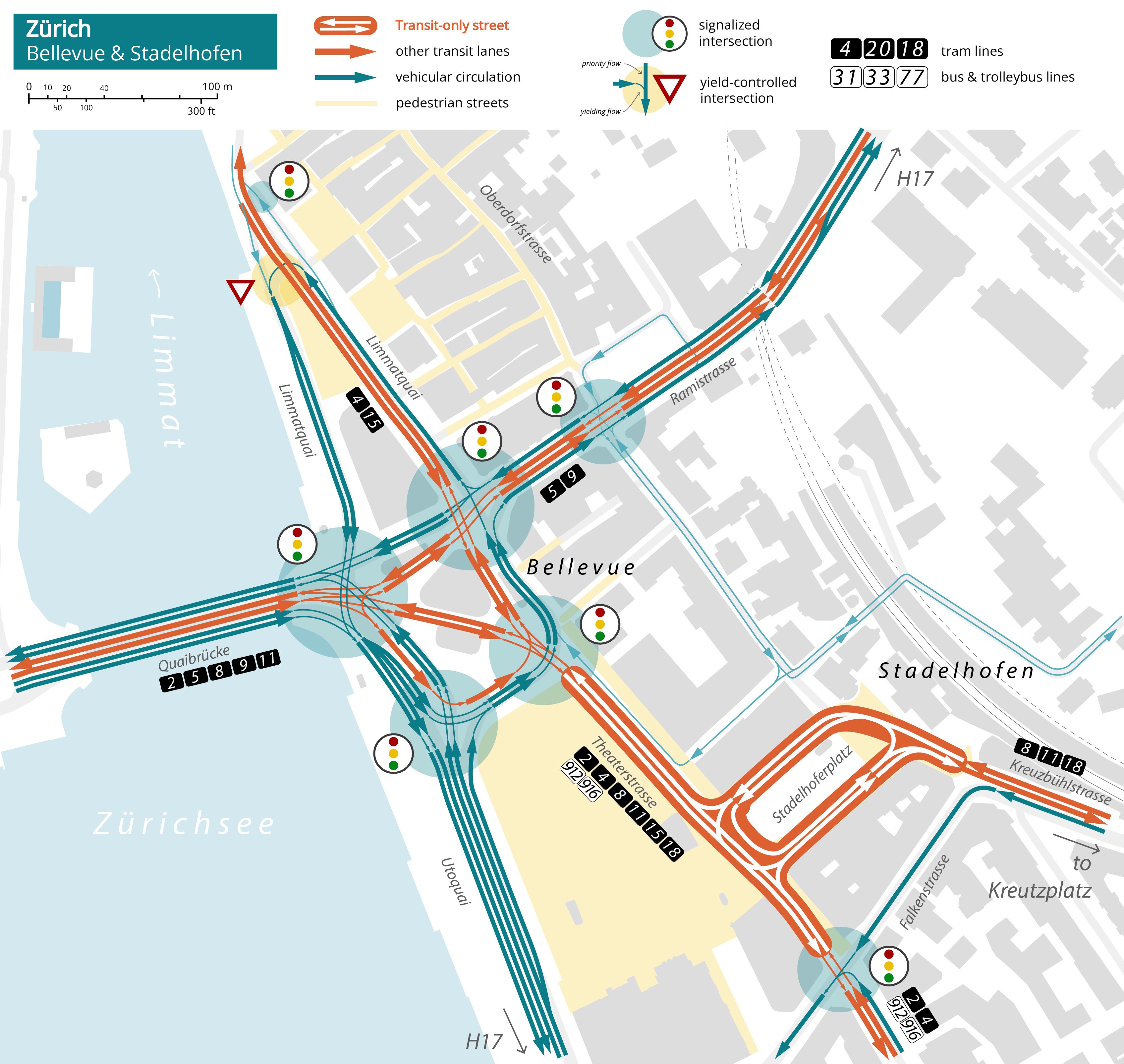
The extended Bellevue/Stadelhofen area is one of the city’s main transit nodes, with seven tram lines and several bus routes converging and crossing through the district. Bellevueplatz is also a major regional traffic node, as traffic from the highways along both shores of Lake Zürich and the national road H17 converges there.
In the southbound direction, the through movement of the H17, which would normally require a left turn from Rämistrasse onto Utoquai, is instead routed through an indirect right–left–straight “hook” (L1) movement via Limmatquai. This configuration simplifies the management of the intersection at the eastern end of Quaibrücke, where direct southbound left turns would otherwise require a dedicated signal phase conflicting with tram operations and heavy traffic flows. The indirect routing also provides sufficient space for vehicle queues to build up without obstructing the main intersection.
In addition to this indirect left-turn arrangement, the configuration of the node has undergone a long process of evolution marked by the progressive simplification of traffic movements as several approaches were reserved for local traffic and transit. The indirect left turn via the Limmatquai hook was introduced in the 1970s for traffic arriving from Rämistrasse and Theaterstrasse, alongside the conversion of Theaterstrasse to one-way traffic operation.
Later, through traffic approaching from the southwest was diverted away from the node when Theatergasse and Stadelhoferplatz were restricted to transit-only traffic in the early 1990s, in conjunction with the opening of the cross-city S-Bahn tunnel, which transformed Stadelhofen into a major regional transit hub. The node reached its current configuration in the early 2000s, when Limmatquai through the Old Town was closed to through traffic (see the related use-case).